Olle 2

Olle_2_1

From Olle trail 1 we went straight on to Olle trail 2, covering the first few kilometres as it got dark on Saturday evening. This early part passes through wetlands, a habitat for migrating birds, and significant stretches were diverted to prevent disturbance.

The rest of the trail passes through farmland before reaching the coast at its end point at Onpyeong Pogu. There was the usual scattering of grave sites on the side of the oreum that the trail crosses and in fields.

Olle_2_2

Olle_2_4

And here’s a kohlrabi to finish with. There are plenty of fields of radish, carrots and potatoes but fewer kohlrabi.

Agricultural machinery, graves and root vegetables; this is the life!
Olle_2_3

Olle 21

Olle_21_1

We’ve just completed Olle 21, as far from Global Education City as you can get on Jeju, right in the north east corner of the island. It’s a relatively short trail, joining the end of Olle 20 to a point part way through Olle 1. Given that we started on Olle 5 a year ago, we’ve just got four to go to complete the circuit.

The village in the first two photos is the small port of Hado, a couple of kilometers after the start of the trail. It’s surrounded by a substantial and partly rebuilt wall, defence against the Japanese during the Joeson Dynasty. I assume the rebuilding is cosmetic rather than anything else.

Olle_21_2

And there are plenty of reminders that the Haenyo, women divers, are a feature of this part of the island. The trail starts at the Haenyo museum and there are several statues on the rocks along the shoreline. We even saw some real ones working in the water in the bay as we ate lunch – noodles with seafood.

Olle_21_3

This part of Jeju also seems to be carrot country. The soil appears to be sufficiently light and clear of rock for carrot to be a common crop, along with radish and potatoes. The ladies below are packing the harvested carrots into boxes; there also seems to be a real waste, with lots of misshapen and split ones being left behind in the field.

Olle_21_4

Sanbangsan and the rice fields

Sanbangsan_1

In the latest in the series of photos of Jeju crops taken across stone walls, here are some pictures of a rice field near Museuplo. There isn’t much rice on Jeju – there’s plenty on the mainland – because the soil drains too well. The top photo has Sanbangsan, visible from miles around, in the background.

The bottom photo – same wall, same rice field – shows a water tower. These are a feature of the Jeju landscape and I’ve been meaning to write about those for a while. Water towers of Jeju – watch this space.

Sanbangsan_2

Sesame

Sesame_1

An elderly gentleman approached me as I took these photos. He had enough English to tell me his age (70), to point to his home behind a stone wall, and to tell me that he was born there. He also confirmed the identity of the plants.

It’s another reminder that we’ve been here a year. These are common sights in this part of Jeju in late summer – bundles of the plant propped against walls, spread on the ground in car parks, on cycle ways, at the side the road. The difference between last year and this is that I know what it is. I should have worked it out earlier: it’s sesame. The pods are filled with seeds.

Sesame_2

The photo below shows bundles of sesame leaning against a low stone wall and covered with plastic. It also shows a couple of tombs in the field behind, Mt Dan, and, furthest away, Sangbansan. That’s not a bad landscape to pass on the way to the supermarket.

Sesame_3

Olle 14

Olle_14_1

I don’t suppose there were many other people walking Olle 14 today; they’d have got wet if they had been, sooner or later. Even so, it was still good to be out on the trail.

Olle 14 starts in Jeoji, very close to Global Education City, and makes its way north-west until it reaches the coast. It then turns northwards past Hyeopjae Beach and ends at Hallim. This is the part of Jeju where the prickly pear grows, both wild and farmed. I wrote a blog about it before, but now they’re covered in yellow flowers – and, today, in raindrops.

Olle_14_2

Olle_14_3

Olle_14_4

Fields of green

Millet1

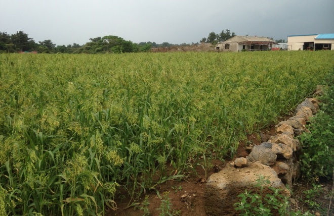
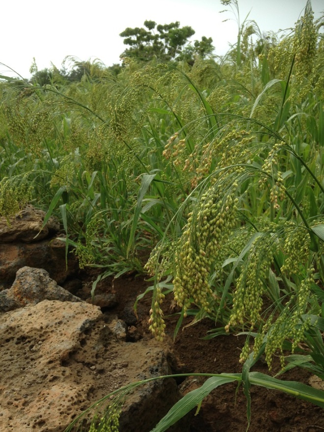
Jeju is said to have an abundance of three things: rocks, women and wind. The first two refer to the volcanic rock that’s everywhere and to the women who work the fields and dive for fish. Jeju men are reputed to be lazy and it’s common to see teams of women toiling in the fields.

It can be windy here and there’s a Jeju photographer, the late Kim Young Gap, who captured the effects of the wind by using slow shutter speeds for his landscape photos. The blurred images of grasses and branches in the photos testify to the wind playing across the landscape.

I haven’t tried to emulate Kim Young Gap in these photos – I took them with my iPhone, after all. I think the crop is millet, which I spotted as I headed to the west coast on my bike last weekend, and I enjoyed the combination of the golden green of the crop and the darkness of the earth and the rocks.

Millet2

Olle 12

Olle_11_1

Olle trail 12 starts some distance from the sea and heads westwards to the coast before turning north. It’s a working, agricultural landscape; there are large areas of onions, fields of barley, potatoes, radishes, cabbages and more. Today, there were scattered people tending to crops, and teams of people (mainly women) harvesting.

The lady below was preparing lunch. It looked as if she had lots of mouths to feed.

Olle_11_2

Prickly pear

PricklyPear2

I’ve seen Jeju speciality prickly pear flavoured chocolates often enough, and know that you can get various other products based on prickly pear, but it’s still a surprise to see fields of the plant. The photo below was taken near Jeju’s west coast and there are plenty of fields just like this.

I don’t know how you harvest the plant; you must need some robust protective gear.

PricklyPear1

Follow the plough

Spring4OK, so it’s not a plough in the photo, but the fields that now cover the old Altteuru airfield were full of activity this morning. Also, it’s my 100th post on this blog so I feel entitled to a little poetic license. People were tilling and planting, and laying out polythene over the soil, often stretched over bamboo hoops to give plants room to grow underneath. I wonder if the lady in the photo above ever gets to drive the tractor while the man works behind it?

Spring1There were also plenty of crops being harvested, or ready to be harvested. Those are sacks of large radish (like daikon in Japan) in the photo above, with a grave site immediately behind. I posted a photo of a cabbage before but here’s another one for good measure.

Spring5

And there’s canola (or oil seed rape) everywhere, cultivated or amongst other cultivated crops or on uncultivated patches of land.

Spring3

Altteuru airfield

Altteuru_airfield_2

Today, this area of south-west Jeju grows vegetables of all kinds – radishes, leeks, cabbages, potatoes and more – but there are still plenty of clues about the wartime role of this flat land.

That tree-topped hillock in the photo below isn’t natural: It covers a man-made shelter. You can go down the steps in the little gap near the right-hand end and emerge at the other end.

Altteuru_airfield_3

The shelter is a relic of the war, and this was an airfield built by the Japanese to defend Japan and from which to launch bombing missions on China. The photo below shows some of the bunkers that remain as well as showing, in the distance, how Sanbangsan rises out of the landscape.

Altteuru_airfield_1